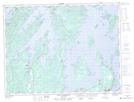
Maps showing Bulley's Cove, Newfoundland and Labrador
Bulley's Cove is a Unincorporated area located in Newfoundland and Labrador and has an elevation of 33 meters.
- Latitude: 49° 20' 59'' North (decimal: 49.3497222)
- Longitude: 55° 21' 23'' West (decimal: -55.3563888)
- Topography Feature Category: Unincorporated area
- Geographical Feature: Locality
- Canadian Province/Territory: Newfoundland and Labrador
- Elevation: 33 meters
- Atlas of Canada Locator Map: Bulley's Cove
- GPS Coordinate Locator Map: Bulley's Cove Lat/Long
Bulley's Cove NTS Map Sheets