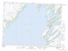
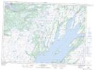
Maps showing Burnt Hill, Newfoundland and Labrador
Burnt Hill is a Mountain located in Newfoundland and Labrador.
- Latitude: 47° 1' 00'' North (decimal: 47.0166666)
- Longitude: 53° 58' 37'' West (decimal: -53.9769444)
- Topography Feature Category: Mountain
- Geographical Feature: Hill
- Canadian Province/Territory: Newfoundland and Labrador
- GPS Coordinate Locator Map: Burnt Hill Lat/Long
Burnt Hill NTS Map Sheets