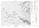
Maps showing Burnt Point, Newfoundland and Labrador
Burnt Point is a Cape located in Newfoundland and Labrador.
- Latitude: 52° 47' 3'' North (decimal: 52.7840896)
- Longitude: 56° 4' 55'' West (decimal: -56.0819669)
- Topography Feature Category: Cape
- Geographical Feature: Point
- Canadian Province/Territory: Newfoundland and Labrador
- Atlas of Canada Locator Map: Burnt Point
- GPS Coordinate Locator Map: Burnt Point Lat/Long
Burnt Point NTS Map Sheets