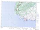
Maps showing Channel-Port aux Basques, Newfoundland and Labrador
Channel-Port aux Basques is a Town located in Newfoundland and Labrador and has an elevation of 0 meters.
- Latitude: 47° 35' 44'' North (decimal: 47.5955805)
- Longitude: 59° 8' 7'' West (decimal: -59.1352916)
- Topography Feature Category: Town
- Geographical Feature: Town
- Canadian Province/Territory: Newfoundland and Labrador
- Elevation: 0 meters
- Atlas of Canada Locator Map: Channel-Port aux Basques
- GPS Coordinate Locator Map: Channel-Port aux Basques Lat/Long
Channel-Port aux Basques NTS Map Sheets