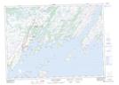
Maps showing Chimney Rocks, Newfoundland and Labrador
Chimney Rocks is a Shoal located in Newfoundland and Labrador.
- Latitude: 47° 17' 31'' North (decimal: 47.2919444)
- Longitude: 54° 49' 34'' West (decimal: -54.8261111)
- Topography Feature Category: Shoal
- Geographical Feature: Rocks
- Canadian Province/Territory: Newfoundland and Labrador
- Atlas of Canada Locator Map: Chimney Rocks
- GPS Coordinate Locator Map: Chimney Rocks Lat/Long
Chimney Rocks NTS Map Sheets