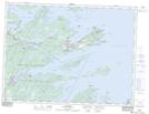
Maps showing Clay Ponds, Newfoundland and Labrador
Clay Ponds is a Lake located in Newfoundland and Labrador and has an elevation of 113 meters.
- Latitude: 48° 31' 18'' North (decimal: 48.5216666)
- Longitude: 53° 51' 53'' West (decimal: -53.8647222)
- Topography Feature Category: Lake
- Geographical Feature: Ponds
- Canadian Province/Territory: Newfoundland and Labrador
- Elevation: 113 meters
- Atlas of Canada Locator Map: Clay Ponds
- GPS Coordinate Locator Map: Clay Ponds Lat/Long