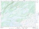
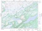
Maps showing Costigan Lake, Newfoundland and Labrador
Costigan Lake is a Lake located in Newfoundland and Labrador and has an elevation of 330 meters.
- Latitude: 48° 30' 46'' North (decimal: 48.5127777)
- Longitude: 57° 4' 37'' West (decimal: -57.0769444)
- Topography Feature Category: Lake
- Geographical Feature: Lake
- Canadian Province/Territory: Newfoundland and Labrador
- Elevation: 330 meters
- Atlas of Canada Locator Map: Costigan Lake
- GPS Coordinate Locator Map: Costigan Lake Lat/Long
Costigan Lake NTS Map Sheets