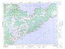
Maps showing Cape Coup de Hache, Newfoundland and Labrador
Cape Coup de Hache is a Cape located in Newfoundland and Labrador and has an elevation of 24 meters.
- Latitude: 49° 55' 48'' North (decimal: 49.9300000)
- Longitude: 55° 44' 50'' West (decimal: -55.7472222)
- Topography Feature Category: Cape
- Geographical Feature: Cape
- Canadian Province/Territory: Newfoundland and Labrador
- Elevation: 24 meters
- Atlas of Canada Locator Map: Cape Coup de Hache
- GPS Coordinate Locator Map: Cape Coup de Hache Lat/Long
Cape Coup de Hache NTS Map Sheets