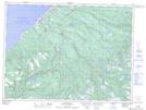
Maps showing Crabbes River, Newfoundland and Labrador
Crabbes River is a River located in Newfoundland and Labrador and has an elevation of 82 meters.
- Latitude: 48° 13' 9'' North (decimal: 48.2192420)
- Longitude: 58° 51' 44'' West (decimal: -58.8621989)
- Topography Feature Category: River
- Geographical Feature: River
- Canadian Province/Territory: Newfoundland and Labrador
- Elevation: 82 meters
- Atlas of Canada Locator Map: Crabbes River
- GPS Coordinate Locator Map: Crabbes River Lat/Long
Crabbes River NTS Map Sheets