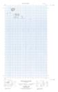
Maps showing The Cubs, Newfoundland and Labrador
The Cubs is a Island located in Newfoundland and Labrador.
- Latitude: 54° 28' 26'' North (decimal: 54.4739126)
- Longitude: 56° 58' 1'' West (decimal: -56.9670411)
- Topography Feature Category: Island
- Geographical Feature: Islands
- Canadian Province/Territory: Newfoundland and Labrador
- Atlas of Canada Locator Map: The Cubs
- GPS Coordinate Locator Map: The Cubs Lat/Long
The Cubs NTS Map Sheets