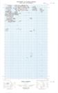
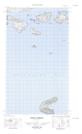
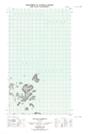
Maps showing Cut Throat Island, Newfoundland and Labrador
Cut Throat Island is a Island located in Newfoundland and Labrador and has an elevation of 47 meters.
- Latitude: 54° 29' 23'' North (decimal: 54.4897393)
- Longitude: 57° 8' 45'' West (decimal: -57.1458463)
- Topography Feature Category: Island
- Geographical Feature: Island
- Canadian Province/Territory: Newfoundland and Labrador
- Elevation: 47 meters
- Atlas of Canada Locator Map: Cut Throat Island
- GPS Coordinate Locator Map: Cut Throat Island Lat/Long
Cut Throat Island NTS Map Sheets