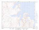
Maps showing Mount Dalhousie, Newfoundland and Labrador
Mount Dalhousie is a Mountain located in Newfoundland and Labrador and has an elevation of 520 meters.
- Latitude: 59° 0' 44'' North (decimal: 59.0121974)
- Longitude: 63° 17' 5'' West (decimal: -63.2847907)
- Topography Feature Category: Mountain
- Geographical Feature: Mount
- Canadian Province/Territory: Newfoundland and Labrador
- Elevation: 520 meters
- Atlas of Canada Locator Map: Mount Dalhousie
- GPS Coordinate Locator Map: Mount Dalhousie Lat/Long
Mount Dalhousie NTS Map Sheets