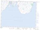
Maps showing Daniel's Point, Newfoundland and Labrador
Daniel's Point is a Unincorporated area located in Newfoundland and Labrador and has an elevation of 3 meters.
- Latitude: 46° 45' 9'' North (decimal: 46.7525000)
- Longitude: 53° 22' 39'' West (decimal: -53.3774999)
- Topography Feature Category: Unincorporated area
- Geographical Feature: Settlement
- Canadian Province/Territory: Newfoundland and Labrador
- Elevation: 3 meters
- Atlas of Canada Locator Map: Daniel's Point
- GPS Coordinate Locator Map: Daniel's Point Lat/Long
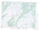
Daniel's Point NTS Map Sheets