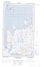
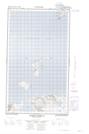
Maps showing Deus Cape, Torngat Mountains, Newfoundland and Labrador
Deus Cape is a Cape located in Torngat Mountains, Newfoundland and Labrador and has an elevation of 20 meters.
- Latitude: 54° 52' 47'' North (decimal: 54.8797222)
- Longitude: 58° 12' 59'' West (decimal: -58.2163888)
- Topography Feature Category: Cape
- Geographical Feature: Cape
- Canadian Province/Territory: Newfoundland and Labrador
- Elevation: 20 meters
- Location: Torngat Mountains
- Atlas of Canada Locator Map: Deus Cape
- GPS Coordinate Locator Map: Deus Cape Lat/Long
Deus Cape NTS Map Sheets