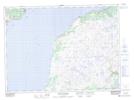
Maps showing Devil Brook Island, Newfoundland and Labrador
Devil Brook Island is a Island located in Newfoundland and Labrador.
- Latitude: 47° 16' 28'' North (decimal: 47.2744444)
- Longitude: 55° 19' 18'' West (decimal: -55.3216666)
- Topography Feature Category: Island
- Geographical Feature: Island
- Canadian Province/Territory: Newfoundland and Labrador
- GPS Coordinate Locator Map: Devil Brook Island Lat/Long
Devil Brook Island NTS Map Sheets