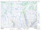
Maps showing Devils Dancing Table, Newfoundland and Labrador
Devils Dancing Table is a Mountain located in Newfoundland and Labrador and has an elevation of 284 meters.
- Latitude: 47° 45' 59'' North (decimal: 47.7663888)
- Longitude: 56° 9' 6'' West (decimal: -56.1516666)
- Topography Feature Category: Mountain
- Geographical Feature: Hill
- Canadian Province/Territory: Newfoundland and Labrador
- Elevation: 284 meters
- Atlas of Canada Locator Map: Devils Dancing Table
- GPS Coordinate Locator Map: Devils Dancing Table Lat/Long
Devils Dancing Table NTS Map Sheets