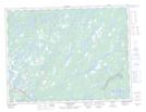
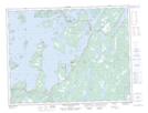
Maps showing Dildo Pond, Newfoundland and Labrador
Dildo Pond is a Lake located in Newfoundland and Labrador and has an elevation of 12 meters.
- Latitude: 49° 15' 3'' North (decimal: 49.2509361)
- Longitude: 54° 52' 26'' West (decimal: -54.8740109)
- Topography Feature Category: Lake
- Geographical Feature: Pond
- Canadian Province/Territory: Newfoundland and Labrador
- Elevation: 12 meters
- Atlas of Canada Locator Map: Dildo Pond
- GPS Coordinate Locator Map: Dildo Pond Lat/Long
Dildo Pond NTS Map Sheets