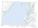
Maps showing Double Road Point, Newfoundland and Labrador
Double Road Point is a Cape located in Newfoundland and Labrador and has an elevation of 11 meters.
- Latitude: 46° 55' 27'' North (decimal: 46.9241666)
- Longitude: 53° 35' 19'' West (decimal: -53.5886111)
- Topography Feature Category: Cape
- Geographical Feature: Point
- Canadian Province/Territory: Newfoundland and Labrador
- Elevation: 11 meters
- Atlas of Canada Locator Map: Double Road Point
- GPS Coordinate Locator Map: Double Road Point Lat/Long
Double Road Point NTS Map Sheets