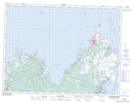
Maps showing Drake Pond, Newfoundland and Labrador
Drake Pond is a Lake located in Newfoundland and Labrador and has an elevation of 134 meters.
- Latitude: 48° 33' 21'' North (decimal: 48.5558333)
- Longitude: 53° 24' 54'' West (decimal: -53.4149999)
- Topography Feature Category: Lake
- Geographical Feature: Pond
- Canadian Province/Territory: Newfoundland and Labrador
- Elevation: 134 meters
- Atlas of Canada Locator Map: Drake Pond
- GPS Coordinate Locator Map: Drake Pond Lat/Long
Drake Pond NTS Map Sheets