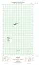
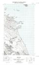
Maps showing Drakes Island, Newfoundland and Labrador
Drakes Island is a Island located in Newfoundland and Labrador.
- Latitude: 54° 10' 59'' North (decimal: 54.1830855)
- Longitude: 57° 22' 30'' West (decimal: -57.3750136)
- Topography Feature Category: Island
- Geographical Feature: Island
- Canadian Province/Territory: Newfoundland and Labrador
- Atlas of Canada Locator Map: Drakes Island
- GPS Coordinate Locator Map: Drakes Island Lat/Long
Drakes Island NTS Map Sheets