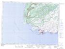
Maps showing East Baldwin Rock, Newfoundland and Labrador
East Baldwin Rock is a Shoal located in Newfoundland and Labrador.
- Latitude: 47° 34' 28'' North (decimal: 47.5744422)
- Longitude: 59° 7' 31'' West (decimal: -59.1252522)
- Topography Feature Category: Shoal
- Geographical Feature: Rock
- Canadian Province/Territory: Newfoundland and Labrador
- Atlas of Canada Locator Map: East Baldwin Rock
- GPS Coordinate Locator Map: East Baldwin Rock Lat/Long
East Baldwin Rock NTS Map Sheets