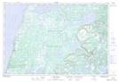
Maps showing Eastern Blue Pond, Newfoundland and Labrador
Eastern Blue Pond is a Lake located in Newfoundland and Labrador and has an elevation of 45 meters.
- Latitude: 50° 26' 58'' North (decimal: 50.4494444)
- Longitude: 57° 6' 17'' West (decimal: -57.1047222)
- Topography Feature Category: Lake
- Geographical Feature: Pond
- Canadian Province/Territory: Newfoundland and Labrador
- Elevation: 45 meters
- Atlas of Canada Locator Map: Eastern Blue Pond
- GPS Coordinate Locator Map: Eastern Blue Pond Lat/Long
Eastern Blue Pond NTS Map Sheets