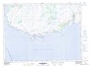
Maps showing Eastern Hare Hills, Newfoundland and Labrador
Eastern Hare Hills is a Mountain located in Newfoundland and Labrador and has an elevation of 216 meters.
- Latitude: 46° 59' 2'' North (decimal: 46.9838888)
- Longitude: 55° 48' 31'' West (decimal: -55.8086111)
- Topography Feature Category: Mountain
- Geographical Feature: Hills
- Canadian Province/Territory: Newfoundland and Labrador
- Elevation: 216 meters
- Atlas of Canada Locator Map: Eastern Hare Hills
- GPS Coordinate Locator Map: Eastern Hare Hills Lat/Long
Eastern Hare Hills NTS Map Sheets