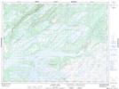
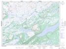
Maps showing East Tulks Pond, Windsor-Buchans, Newfoundland and Labrador
East Tulks Pond is a Lake located in Windsor-Buchans, Newfoundland and Labrador and has an elevation of 365 meters.
- Latitude: 48° 28' 43'' North (decimal: 48.4786111)
- Longitude: 57° 12' 20'' West (decimal: -57.2055555)
- Topography Feature Category: Lake
- Geographical Feature: Pond
- Canadian Province/Territory: Newfoundland and Labrador
- Elevation: 365 meters
- Location: Windsor-Buchans
- Atlas of Canada Locator Map: East Tulks Pond
- GPS Coordinate Locator Map: East Tulks Pond Lat/Long
East Tulks Pond NTS Map Sheets