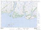
Maps showing Emily Storehouse Cove, Newfoundland and Labrador
Emily Storehouse Cove is a Bay located in Newfoundland and Labrador and has an elevation of 56 meters.
- Latitude: 47° 38' 4'' North (decimal: 47.6343798)
- Longitude: 57° 25' 13'' West (decimal: -57.4202099)
- Topography Feature Category: Bay
- Geographical Feature: Cove
- Canadian Province/Territory: Newfoundland and Labrador
- Elevation: 56 meters
- Atlas of Canada Locator Map: Emily Storehouse Cove
- GPS Coordinate Locator Map: Emily Storehouse Cove Lat/Long