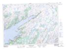
Maps showing English Harbour East, Newfoundland and Labrador
English Harbour East is a Town located in Newfoundland and Labrador and has an elevation of 27 meters.
- Latitude: 47° 38' 46'' North (decimal: 47.6460805)
- Longitude: 54° 53' 34'' West (decimal: -54.8927833)
- Topography Feature Category: Town
- Geographical Feature: Town
- Canadian Province/Territory: Newfoundland and Labrador
- Elevation: 27 meters
- Atlas of Canada Locator Map: English Harbour East
- GPS Coordinate Locator Map: English Harbour East Lat/Long
English Harbour East NTS Map Sheets