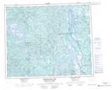
Maps showing Esker Point, Newfoundland and Labrador
Esker Point is a Cape located in Newfoundland and Labrador and has an elevation of 487 meters.
- Latitude: 53° 54' 0'' North (decimal: 53.9000836)
- Longitude: 66° 27' 57'' West (decimal: -66.4659502)
- Topography Feature Category: Cape
- Geographical Feature: Point
- Canadian Province/Territory: Newfoundland and Labrador
- Elevation: 487 meters
- Atlas of Canada Locator Map: Esker Point
- GPS Coordinate Locator Map: Esker Point Lat/Long
Esker Point NTS Map Sheets