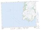
Maps showing False Cay, Newfoundland and Labrador
False Cay is a Island located in Newfoundland and Labrador.
- Latitude: 46° 44' 10'' North (decimal: 46.7361111)
- Longitude: 54° 12' 26'' West (decimal: -54.2072222)
- Topography Feature Category: Island
- Geographical Feature: Cay
- Canadian Province/Territory: Newfoundland and Labrador
- Atlas of Canada Locator Map: False Cay
- GPS Coordinate Locator Map: False Cay Lat/Long
False Cay NTS Map Sheets