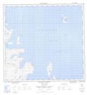
Maps showing Finger Hill Island, Newfoundland and Labrador
Finger Hill Island is a Island located in Newfoundland and Labrador and has an elevation of 39 meters.
- Latitude: 57° 59' 15'' North (decimal: 57.9876340)
- Longitude: 62° 11' 50'' West (decimal: -62.1972101)
- Topography Feature Category: Island
- Geographical Feature: Island
- Canadian Province/Territory: Newfoundland and Labrador
- Elevation: 39 meters
- Atlas of Canada Locator Map: Finger Hill Island
- GPS Coordinate Locator Map: Finger Hill Island Lat/Long
Finger Hill Island NTS Map Sheets