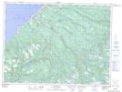
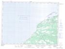
Maps showing Fischells Dribble, Newfoundland and Labrador
Fischells Dribble is a River located in Newfoundland and Labrador and has an elevation of 234 meters.
- Latitude: 48° 18' 4'' North (decimal: 48.3011111)
- Longitude: 58° 38' 24'' West (decimal: -58.6399999)
- Topography Feature Category: River
- Geographical Feature: Dribble
- Canadian Province/Territory: Newfoundland and Labrador
- Elevation: 234 meters
- Atlas of Canada Locator Map: Fischells Dribble
- GPS Coordinate Locator Map: Fischells Dribble Lat/Long
Fischells Dribble NTS Map Sheets