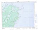
Maps showing Fischot Islands, Newfoundland and Labrador
Fischot Islands is a Unincorporated area located in Newfoundland and Labrador and has an elevation of 5 meters.
- Latitude: 51° 10' 56'' North (decimal: 51.1822222)
- Longitude: 55° 41' 12'' West (decimal: -55.6866666)
- Topography Feature Category: Unincorporated area
- Geographical Feature: Settlement
- Canadian Province/Territory: Newfoundland and Labrador
- Elevation: 5 meters
- Atlas of Canada Locator Map: Fischot Islands
- GPS Coordinate Locator Map: Fischot Islands Lat/Long
Fischot Islands NTS Map Sheets