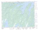
Maps showing Five Island Pond Brook, Newfoundland and Labrador
Five Island Pond Brook is a River located in Newfoundland and Labrador and has an elevation of 89 meters.
- Latitude: 49° 23' 47'' North (decimal: 49.3963744)
- Longitude: 55° 55' 17'' West (decimal: -55.9215211)
- Topography Feature Category: River
- Geographical Feature: Brook
- Canadian Province/Territory: Newfoundland and Labrador
- Elevation: 89 meters
- Atlas of Canada Locator Map: Five Island Pond Brook
- GPS Coordinate Locator Map: Five Island Pond Brook Lat/Long
Five Island Pond Brook NTS Map Sheets