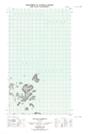
Maps showing Fox Island, Newfoundland and Labrador
Fox Island is a Island located in Newfoundland and Labrador and has an elevation of 6 meters.
- Latitude: 54° 33' 55'' North (decimal: 54.5652990)
- Longitude: 57° 14' 26'' West (decimal: -57.2404518)
- Topography Feature Category: Island
- Geographical Feature: Island
- Canadian Province/Territory: Newfoundland and Labrador
- Elevation: 6 meters
- Atlas of Canada Locator Map: Fox Island
- GPS Coordinate Locator Map: Fox Island Lat/Long
Fox Island NTS Map Sheets