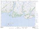
Maps showing Fox Island Rock, Newfoundland and Labrador
Fox Island Rock is a Shoal located in Newfoundland and Labrador and has an elevation of 1 meters.
- Latitude: 47° 34' 46'' North (decimal: 47.5794444)
- Longitude: 57° 16' 57'' West (decimal: -57.2825000)
- Topography Feature Category: Shoal
- Geographical Feature: Rock
- Canadian Province/Territory: Newfoundland and Labrador
- Elevation: 1 meters
- Atlas of Canada Locator Map: Fox Island Rock
- GPS Coordinate Locator Map: Fox Island Rock Lat/Long