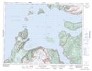
Maps showing French Island, Newfoundland and Labrador
French Island is a Island located in Newfoundland and Labrador.
- Latitude: 49° 12' 51'' North (decimal: 49.2140498)
- Longitude: 58° 20' 3'' West (decimal: -58.3340998)
- Topography Feature Category: Island
- Geographical Feature: Island
- Canadian Province/Territory: Newfoundland and Labrador
- Atlas of Canada Locator Map: French Island
- GPS Coordinate Locator Map: French Island Lat/Long
French Island NTS Map Sheets