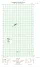
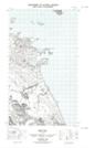
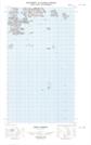
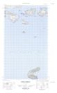
Maps showing George Island, Newfoundland and Labrador
George Island is a Island located in Newfoundland and Labrador and has an elevation of 47 meters.
- Latitude: 54° 15' 40'' North (decimal: 54.2612483)
- Longitude: 57° 20' 26'' West (decimal: -57.3405817)
- Topography Feature Category: Island
- Geographical Feature: Island
- Canadian Province/Territory: Newfoundland and Labrador
- Elevation: 47 meters
- Atlas of Canada Locator Map: George Island
- GPS Coordinate Locator Map: George Island Lat/Long
George Island NTS Map Sheets