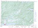
Maps showing Georges Lake, Newfoundland and Labrador
Georges Lake is a Lake located in Newfoundland and Labrador and has an elevation of 129 meters.
- Latitude: 48° 44' 48'' North (decimal: 48.7466666)
- Longitude: 58° 10' 18'' West (decimal: -58.1716666)
- Topography Feature Category: Lake
- Geographical Feature: Lake
- Canadian Province/Territory: Newfoundland and Labrador
- Elevation: 129 meters
- Atlas of Canada Locator Map: Georges Lake
- GPS Coordinate Locator Map: Georges Lake Lat/Long
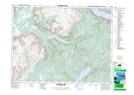
Georges Lake NTS Map Sheets