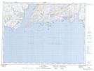
Maps showing Grand Bruit Gull Pond, Newfoundland and Labrador
Grand Bruit Gull Pond is a Lake located in Newfoundland and Labrador and has an elevation of 112 meters.
- Latitude: 47° 41' 57'' North (decimal: 47.6991666)
- Longitude: 58° 11' 54'' West (decimal: -58.1983333)
- Topography Feature Category: Lake
- Geographical Feature: Pond
- Canadian Province/Territory: Newfoundland and Labrador
- Elevation: 112 meters
- Atlas of Canada Locator Map: Grand Bruit Gull Pond
- GPS Coordinate Locator Map: Grand Bruit Gull Pond Lat/Long
Grand Bruit Gull Pond NTS Map Sheets