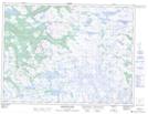
Maps showing The Grass, Newfoundland and Labrador
The Grass is a Low vegetation located in Newfoundland and Labrador and has an elevation of 321 meters.
- Latitude: 48° 9' 38'' North (decimal: 48.1605555)
- Longitude: 58° 19' 00'' West (decimal: -58.3166666)
- Topography Feature Category: Low vegetation
- Geographical Feature: Meadow
- Canadian Province/Territory: Newfoundland and Labrador
- Elevation: 321 meters
- Atlas of Canada Locator Map: The Grass
- GPS Coordinate Locator Map: The Grass Lat/Long
The Grass NTS Map Sheets