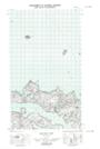
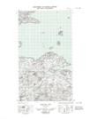
Maps showing Green Island, Newfoundland and Labrador
Green Island is a Island located in Newfoundland and Labrador.
- Latitude: 53° 36' 5'' North (decimal: 53.6013117)
- Longitude: 56° 9' 11'' West (decimal: -56.1529437)
- Topography Feature Category: Island
- Geographical Feature: Island
- Canadian Province/Territory: Newfoundland and Labrador
- Atlas of Canada Locator Map: Green Island
- GPS Coordinate Locator Map: Green Island Lat/Long
Green Island NTS Map Sheets