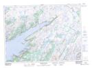
Maps showing The Grip, Newfoundland and Labrador
The Grip is a Channel located in Newfoundland and Labrador and has an elevation of 190 meters.
- Latitude: 47° 44' 36'' North (decimal: 47.7433333)
- Longitude: 54° 48' 1'' West (decimal: -54.8002777)
- Topography Feature Category: Channel
- Geographical Feature: Narrows
- Canadian Province/Territory: Newfoundland and Labrador
- Elevation: 190 meters
- Atlas of Canada Locator Map: The Grip
- GPS Coordinate Locator Map: The Grip Lat/Long
The Grip NTS Map Sheets