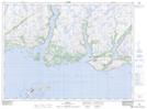
Maps showing Gull Hill, Newfoundland and Labrador
Gull Hill is a Mountain located in Newfoundland and Labrador and has an elevation of 35 meters.
- Latitude: 47° 31' 42'' North (decimal: 47.5283333)
- Longitude: 57° 21' 28'' West (decimal: -57.3577777)
- Topography Feature Category: Mountain
- Geographical Feature: Hill
- Canadian Province/Territory: Newfoundland and Labrador
- Elevation: 35 meters
- Atlas of Canada Locator Map: Gull Hill
- GPS Coordinate Locator Map: Gull Hill Lat/Long