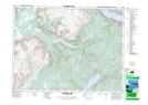
Maps showing Gull Pond Steadies, Newfoundland and Labrador
Gull Pond Steadies is a Lake located in Newfoundland and Labrador.
- Latitude: 48° 46' 25'' North (decimal: 48.7736111)
- Longitude: 58° 1' 57'' West (decimal: -58.0324999)
- Topography Feature Category: Lake
- Geographical Feature: Steadies
- Canadian Province/Territory: Newfoundland and Labrador
- GPS Coordinate Locator Map: Gull Pond Steadies Lat/Long
Gull Pond Steadies NTS Map Sheets