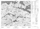
Maps showing Hanrahan Point, Newfoundland and Labrador
Hanrahan Point is a Cape located in Newfoundland and Labrador.
- Latitude: 53° 44' 39'' North (decimal: 53.7441441)
- Longitude: 56° 37' 46'' West (decimal: -56.6294646)
- Topography Feature Category: Cape
- Geographical Feature: Point
- Canadian Province/Territory: Newfoundland and Labrador
- Atlas of Canada Locator Map: Hanrahan Point
- GPS Coordinate Locator Map: Hanrahan Point Lat/Long
Hanrahan Point NTS Map Sheets