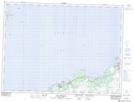
Maps showing Hant's Harbour, Newfoundland and Labrador
Hant's Harbour is a Town located in Newfoundland and Labrador and has an elevation of 20 meters.
- Latitude: 47° 59' 26'' North (decimal: 47.9904222)
- Longitude: 53° 16' 36'' West (decimal: -53.2767138)
- Topography Feature Category: Town
- Geographical Feature: Town
- Canadian Province/Territory: Newfoundland and Labrador
- Elevation: 20 meters
- Atlas of Canada Locator Map: Hant's Harbour
- GPS Coordinate Locator Map: Hant's Harbour Lat/Long
Hant's Harbour NTS Map Sheets