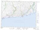
Maps showing Harbour Le Cou, Newfoundland and Labrador
Harbour Le Cou is a Unincorporated area located in Newfoundland and Labrador and has an elevation of 60 meters.
- Latitude: 47° 37' 22'' North (decimal: 47.6227777)
- Longitude: 58° 41' 13'' West (decimal: -58.6869444)
- Topography Feature Category: Unincorporated area
- Geographical Feature: Neighbourhood
- Canadian Province/Territory: Newfoundland and Labrador
- Elevation: 60 meters
- Atlas of Canada Locator Map: Harbour Le Cou
- GPS Coordinate Locator Map: Harbour Le Cou Lat/Long
Harbour Le Cou NTS Map Sheets