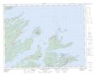
Maps showing Hatchet Rock, Newfoundland and Labrador
Hatchet Rock is a Shoal located in Newfoundland and Labrador and has an elevation of 0 meters.
- Latitude: 49° 38' 6'' North (decimal: 49.6349999)
- Longitude: 55° 40' 21'' West (decimal: -55.6725000)
- Topography Feature Category: Shoal
- Geographical Feature: Rock
- Canadian Province/Territory: Newfoundland and Labrador
- Elevation: 0 meters
- Atlas of Canada Locator Map: Hatchet Rock
- GPS Coordinate Locator Map: Hatchet Rock Lat/Long
Hatchet Rock NTS Map Sheets