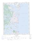
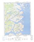
Maps showing Hawke Bay, Newfoundland and Labrador
Hawke Bay is a Bay located in Newfoundland and Labrador and has an elevation of 15 meters.
- Latitude: 53° 0' 28'' North (decimal: 53.0077801)
- Longitude: 55° 59' 41'' West (decimal: -55.9948237)
- Topography Feature Category: Bay
- Geographical Feature: Bay
- Canadian Province/Territory: Newfoundland and Labrador
- Elevation: 15 meters
- Atlas of Canada Locator Map: Hawke Bay
- GPS Coordinate Locator Map: Hawke Bay Lat/Long
Hawke Bay NTS Map Sheets


003D Map Not Available Topographic Map at 1:250,000 scale
003E Map Not Available Topographic Map at 1:250,000 scale
