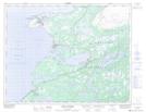
Maps showing Hawke Flat, Newfoundland and Labrador
Hawke Flat is a Beach located in Newfoundland and Labrador and has an elevation of 0 meters.
- Latitude: 50° 36' 45'' North (decimal: 50.6125000)
- Longitude: 57° 18' 21'' West (decimal: -57.3058333)
- Topography Feature Category: Beach
- Geographical Feature: Beach
- Canadian Province/Territory: Newfoundland and Labrador
- Elevation: 0 meters
- Atlas of Canada Locator Map: Hawke Flat
- GPS Coordinate Locator Map: Hawke Flat Lat/Long
Hawke Flat NTS Map Sheets