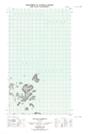
Maps showing Holton Island, Newfoundland and Labrador
Holton Island is a Island located in Newfoundland and Labrador and has an elevation of 28 meters.
- Latitude: 54° 37' 30'' North (decimal: 54.6250346)
- Longitude: 57° 17' 37'' West (decimal: -57.2934754)
- Topography Feature Category: Island
- Geographical Feature: Island
- Canadian Province/Territory: Newfoundland and Labrador
- Elevation: 28 meters
- Atlas of Canada Locator Map: Holton Island
- GPS Coordinate Locator Map: Holton Island Lat/Long
Holton Island NTS Map Sheets